Maps at 360°
Urban Planning, Environmental Protection, Cultural Heritage, Turistic Info, Local Business, No Profit, Research Projects.
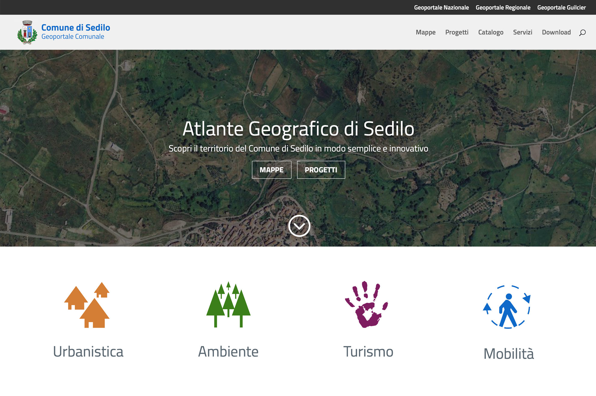
GeoPortal
The interactive geographic atlas.
With GeoNue all the data related to your geographical information system, apps and services are available through a simple and intuitive interface.
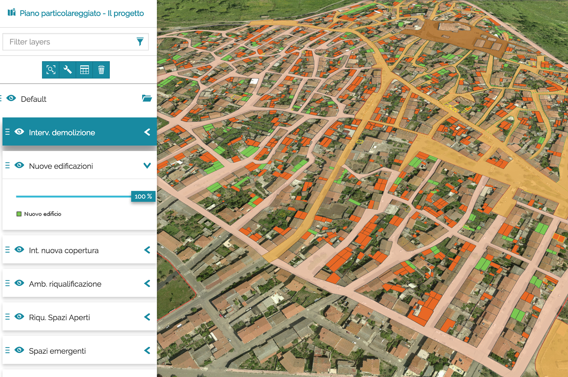
Urban Planning
Plan, share, be part of it.
Create, manage and share territorial and urban development plans without a desktop GIS software. GeoNue tools and services allow you to present your projects in an innovative and simple way.
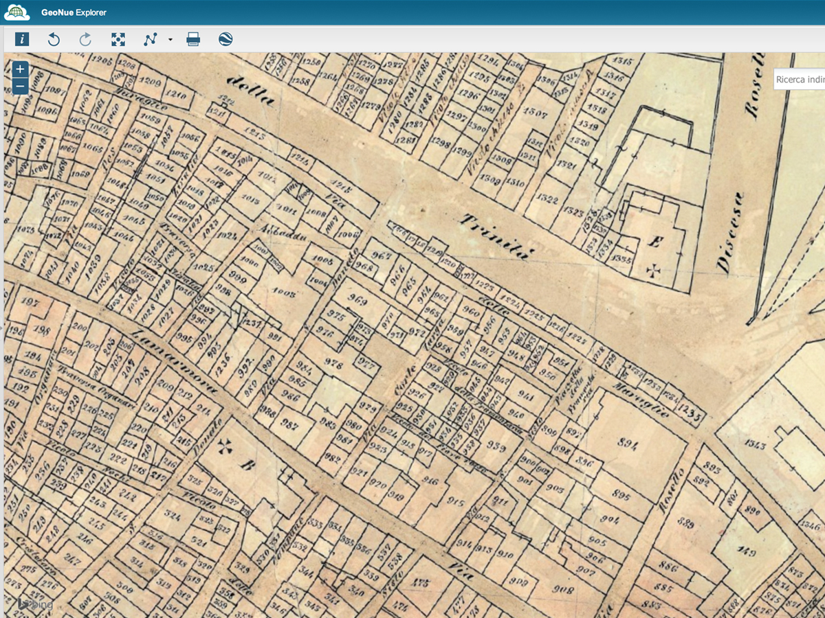
Historical Maps
Tell your city’s story.
Bring historical maps and photos online and make them interactive with GeoNue.
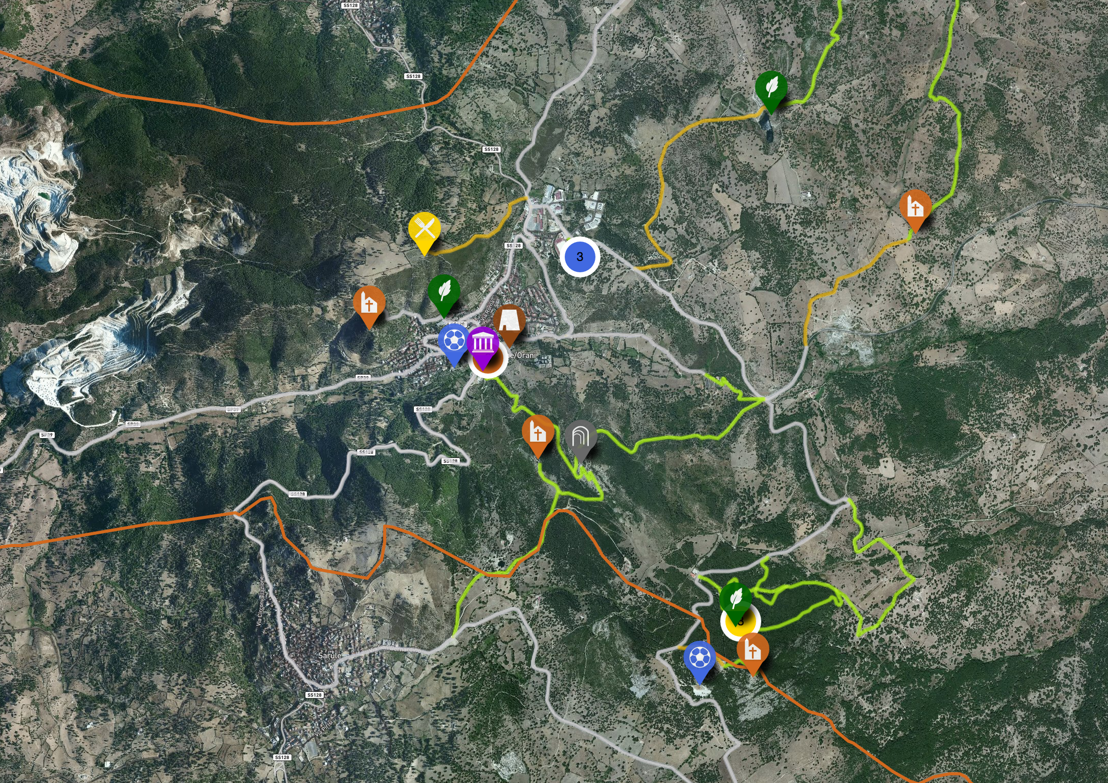
POIs and routes
Share the Life of your local community.
With GeoNue you can plan touristic routes, instantly Geo Tag any POI, show your maps on your website or any other website.
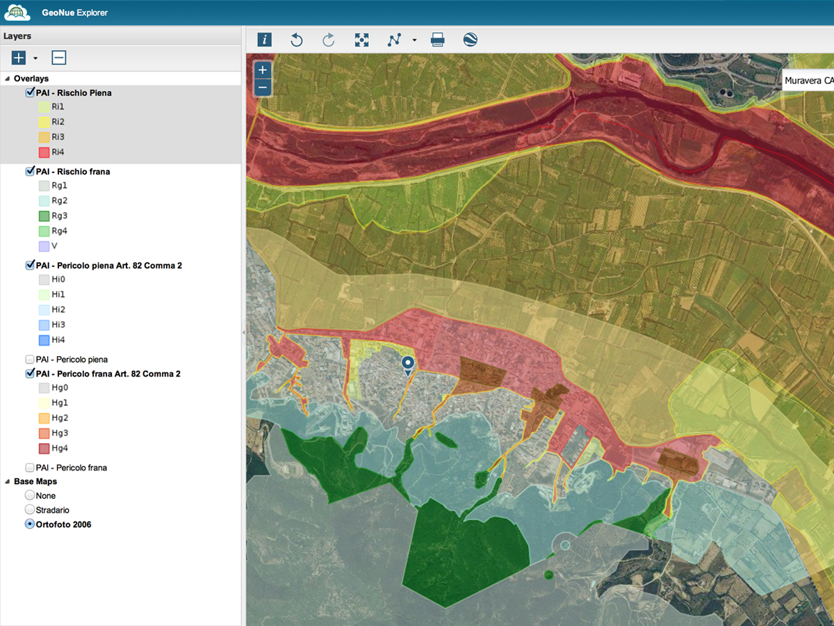
Prevention and safety
Protect your environment.
With GeoNue you can design and share hydrogeological monitoring plan, Civil Protection and Emergency Planning and all information essential to prevent and manage emergencies, to protect and monitor the environment.

Research Projects
Give a new geographical dimension to your scientific projects.
Bring innovation to scientific storytelling in fields like law, economics, agronomy, archaeology.